

Latest News
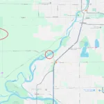
January 13, 2026PRAIRIE HILL ROAD BRIDGE CLOSURE
Prairie Hill Road between IL Route 2 (Blackhawk Boulevard) and
South Bluff Road, in the vicinity of the Village of Rockton and the
City of South Beloit, will be closed to traffic for replacement of the
Prairie Hill Road bridge over the Rock River. Local traffic will have
access on either side of the bridge.
Depending on the weather, work is scheduled to start on Monday
February 2, 2026 and it’s anticipated to be completed by the end of
November, 2026. The duration of the work and road closure is
dependent on the weather. Please use caution in construction zones
and plan to use alternate routes. [...]
Read more...
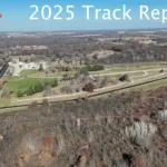
November 16, 2025We’ve officially wrapped up our full repaving project, and of course, we couldn’t resist taking it for a test drive. The results? Exactly what we hoped for. The new surface is incredibly smooth, noticeably grippier, and delivers a confident, consistent feel throughout the entire circuit.
This upgrade marks a significant step forward for the track, and we’re thrilled with its performance. Now all that’s missing is you. We can’t wait to welcome drivers back and let everyone experience the new surface for themselves in 2026!
Watch our preview video below: [...]
Read more...

August 21, 2025Save the Date!
Come on out and drive your Corvette at our Blackhawk Farms Raceway Oktoberfest Auto Track Day – dedicated solely to the Chevrolet Corvette on Saturday, October 24, 2026!
Register online BFR Corvette Oktoberfest Track Day – 10/24/26 | Blackhawk Farms [...]
Read more...


August 4, 2023Looking to fly in to watch some racing? Blackhawk Farms Airport is located right on the track grounds, offering easy access to small planes capable of using a grass runway. This unmanned airstrip is well maintained and ready for landing. There is no charge to use the landing strip. Traffic advisory 122.9
FAA INFORMATION EFFECTIVE 18 MAY 2023
Location
FAA Identifier: LL89Lat/Long: 42-29-14.0520N 089-06-28.3990W42-29.234200N 089-06.473317W42.4872367,-89.1078886(estimated)Elevation: 759 ft. / 231 m (estimated)Variation: 00E (1985)From city: 2 miles NW of ROCKTON, ILTime zone: UTC -5 (UTC -6 during Standard Time)Zip code: 61080
Airport Operations
Airport use: Private use. Permission required prior to landingActivation date: 02/1973Control tower: noARTCC: CHICAGO CENTERFSS: KANKAKEE FLIGHT SERVICE STATIONAttendance: UNATNDDWind indicator: yesSegmented circle: noTraffic advisory 122.9
Airport Communications
WX AWOS-3 at JVL (9 nm N): PHONE 608-758-1723WX ASOS at RFD (18 nm S): PHONE 815-484-6229
Nearby radio navigation aids
VOR radial/distance VOR name Freq VarJVLr179/4.2JANESVILLE VOR/DME114.3003EPLLr028/36.4POLO VOR/DME111.2003E
Airport Services
Airframe service: NONEPowerplant service: NONE
Runway Information
Runway 9/27
Dimensions: 2000 x 100 ft. / 610 x 30 mSurface: turfRUNWAY 9 RUNWAY 27Traffic pattern: leftrightObstructions: none30 ft. pline, 500 ft. from runway [...]
Read more...